IT & System Engineering
NovaGMS
Novatis Ground Movement Visualisation System, Kota Kinabalu International Airport (KKIA)
Overview
Our in-house application that gives air traffic controllers a live map of aircraft and airside vehicles on the manoeuvring area at KKIA, including parking bays the ATC tower cannot see directly. It decodes ADS-B (ASTERIX CAT21) data from the existing ground station at the KK ATC Tower, and vehicles are fitted with ADS-B squitter transmitters. The system runs on a secured, redundant internal network, with the server at KK ATCC and a monitoring position in the tower's Visual Control Room. It improves ground movement awareness, particularly in adverse weather. NovaGMS was developed under the Industrial Collaboration Programme (ICP) of the KK FIR maintenance contract, as Project IP6, with CAAM as the recipient.
Key Features
Live Surface Movement Map
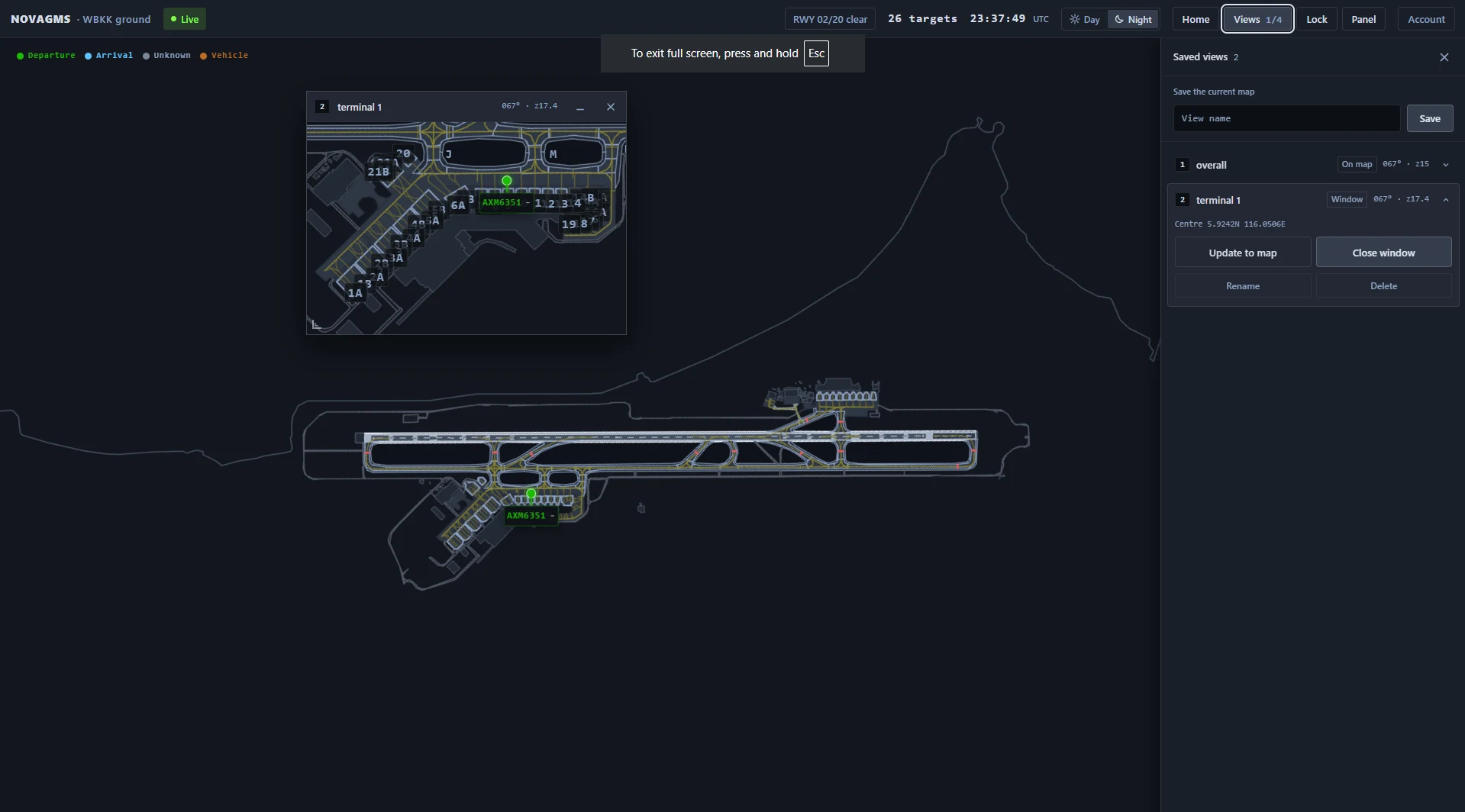
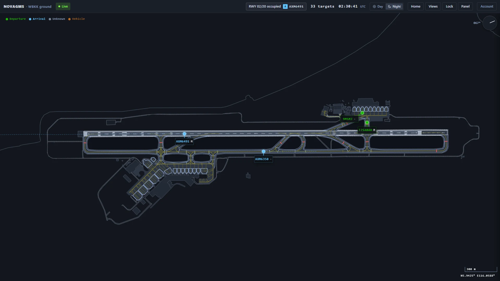
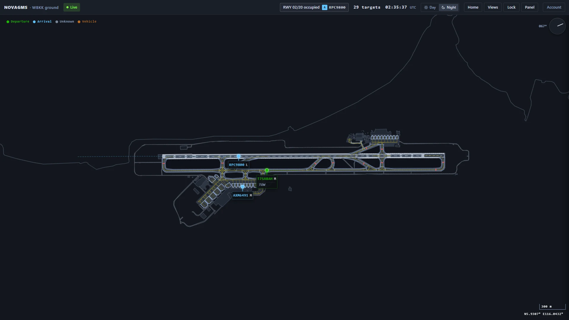
Displays live aircraft and vehicle positions on a detailed airport surface map, colour-coded by movement type (departure, arrival, vehicle, unknown) with position trails and smooth motion between updates.
Target Information Card
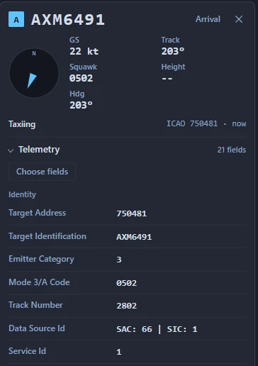
Displays key aircraft information in a dedicated card, with a customizable telemetry panel allowing users to select and monitor specific ADS-B data fields.
Configurable ADS-B Data Fields
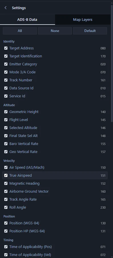
Lets users choose which of more than 40 ADS-B data items appear in the telemetry panel, grouped by identity, altitude, velocity, position, timing and status, with one-click All, None and Default presets.
Live Traffic List
Lists all tracked traffic in a live table showing callsign, movement type, ground speed, track and data age, with emergencies listed first and quick selection by mouse or keyboard.
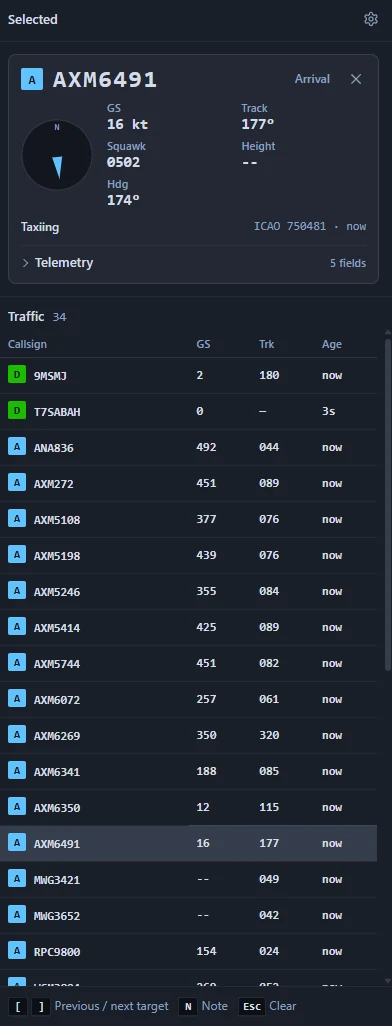
Runway Occupancy Indicator
Monitors the runway continuously and shows whether it is occupied and by which aircraft or vehicle.
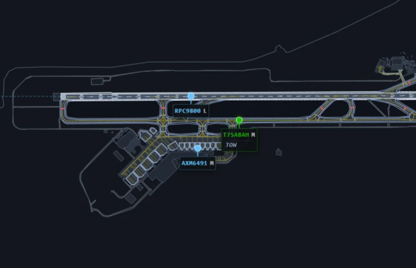
Aircraft Labels with Controller Notes
Attaches a label to every target showing its callsign and wake category, with controller notes displayed directly on the label.
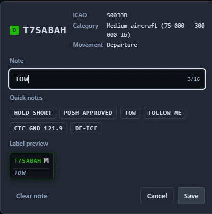
Note Entry
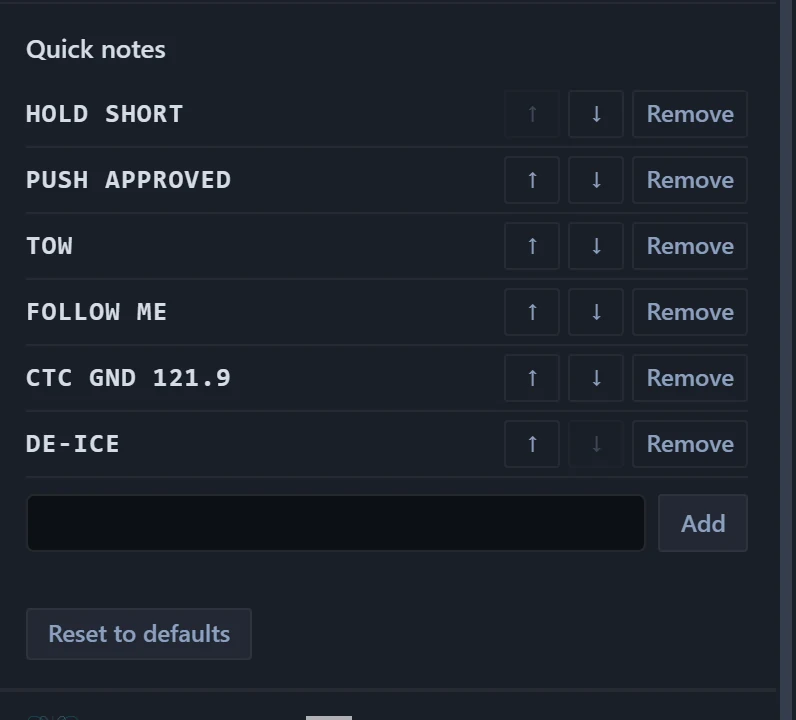
Lets controllers annotate any aircraft in seconds, either by typing a short note or by picking a preset such as HOLD SHORT or PUSH APPROVED, with a live preview of the resulting label.
Customizable Quick Notes
Provides an editable library of quick notes that users can add to, remove from, reorder and reset to defaults, to match local operating procedures.
Map Layer Control
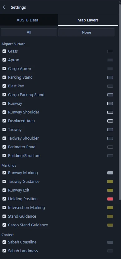
Lets users show or hide individual airport layers, including runways, taxiways, aprons, stands, markings, holding positions and coastline, to reduce clutter and focus on what matters.
Saved Map Views
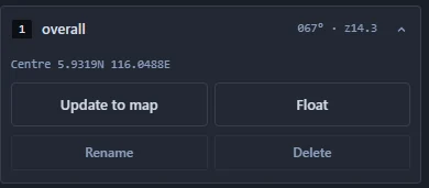
Saves the current map position, zoom and rotation as named views that can be recalled instantly with a click or a number key.
Floating View Windows
Opens up to four saved views as floating windows over the main map, so users can watch several areas of the airfield at the same time.